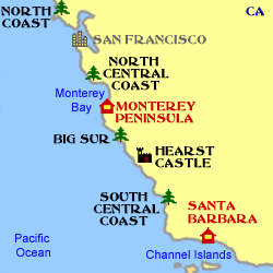
It would be very unfair to Washington State and Oregon to say that California has the best coastal scenery in the USA. What it does have is by far the best combination of scenery with weather as well as some unusual and fascinating coastal towns. This page only scratches the surface of the California coast but if you want to see more there is now a California Coast Trail that you can follow from the bottom of this page or via the Minimap on the right.
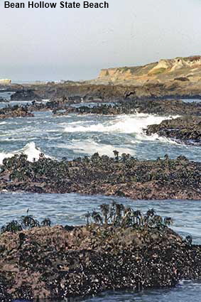
Rocks, surf & seaweed at Bean Hollow State Beach
The coast between San Francisco south to Santa Cruz is often missed as most visitors travel down through Silicon Valley on the eastern side of the peninsula. Bean Hollow is an example of the coast in this area. Preserved as a State Park here the Pacific surf crashes onto rocks covered with seaweed that looks like miniature trees. Tide pools along the beach teem with anemones, crab, sea urchins and other marine inhabitants.
California Coast
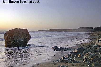
San Simeon Beach at dusk
This is a pivotal point in the Californian coast. To the north is the wild and beautiful Big Sur coast that runs right up to the Monterey Peninsula while to the south the coast down to Los Angeles and San Diego is more developed. Up the hillside overlooking San Simeon stands Hearst Castle, the home of late newspaper magnate. This picture shows a typical scene from the Californian coast, a bleak rock jutting out of the sea, surf from Pacific rollers and mist of sea spray hanging over the coastline.
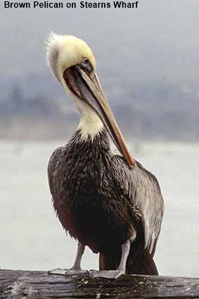
Brown Pelican on Stearns Wharf, Santa Barbara
The fertile waters of the Californian coast make easy pickings for Brown Pelicans. While other types of pelican fish from the surface of the water, the Brown Pelican dives for for them from the air. They nest in colonies, usually on rocky islands, but are readily seen near harbours and wharves where human activities ensure a supply of food often without the effort of diving for it.
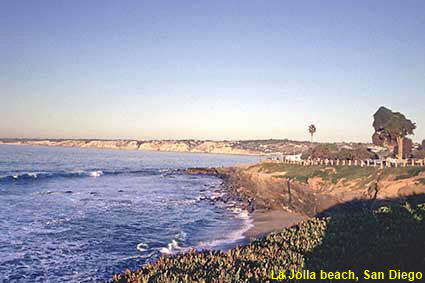
La Jolla beach, San Diego
The coast between Los Angeles and San Diego is largely unremarkable as much of it has been developed, and a long stretch is occupied by Camp Pendleton Marine Corps Base. Nevertheless, there are places worth visiting and La Jolla is one of them. Now a northern suburb of San Diego, La Jolla was founded in 1886 when Frank T. Botsford bought over 160 hectares (400 acres) of pueblo lands known as La Jolla Park. By the 1920s it had grown into an elegant town in the California Spanish style with a population of 4,000. The 1929 stock market crash hit the town hard, but after World War II La Jolla started to grow again and it is now home to over 30,000 people. Although much of La Jolla is modern the town has retained its early style.
DLU100603
Click on Minimap to navigate
Home > US States > The West > California >
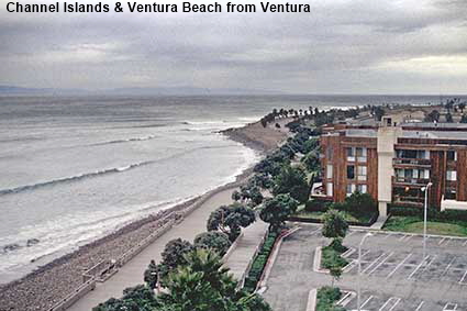
Channel Islands & Ventura Beach from Ventura
Ventura is a typical urban coastal sprawl to the north of Los Angeles, as seen in this picture taken from the Holiday Inn. Just visible on the horizon is something much more interesting. The Channel Islands are eight islands off the coast of southern California that are a world away from LA and Ventura. Five of the islands became a National Park in 1980 and they can be visited by boat from Ventura or Santa Barbara. There are no services on the islands, just the opportunity to walk around some truly unspoiled scenery.
Click on Minimap to navigate
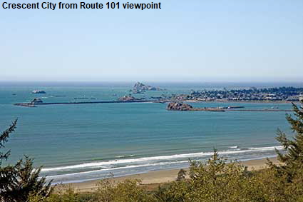
Crescent City from Route 101 viewpoint
Crescent City is way up in the north of California, just 32 kilometres (20 miles) from the Oregon border. It gets its name from the beach visible in the foreground which is in the shape of a long crescent. Lumber and fishing are the main industries here based around the harbour formed by the breakwater visible in this picture. Crescent City sits in a lovely location but it is vulnerable to tsunamis. After Alaska was hit in 1964 by the largest earthquake ever recorded in North America, Crescent City was struck by four tsunami waves, killing 11 people.


Click the arrows above to continue on the California Trail. We have other pages on the California Coast. To see them click below or on the Minimap:


© Mike Elsden 1981 - 2025
The contents of this page may not be reproduced in full or in part without permission