First found by by explorers in 1833, news of the grandeur of Yosemite soon spread and in 1864 the area was given limited protection. Scottish immigrant John Muir first visited Yosemite in 1868 and loved the scenery so much that he returned and stayed for many years. Muir became a writer and actively campaigned to improve the protection of Yosemite. His influence helped to get Yosemite National Park created in 1890 and brought under Federal control in 1906. There are three Yosemites, the valley famously recorded in the black and white photographs of Ansel Adams, the groves of giant trees and the road over the Toiga Pass that takes you across the Sierra Nevada at a height of over 3,000 metres (9,900 feet). The valley and groves are open all year while the Tioga Road is usually only open from mid summer to early autumn. The mountain lakes and alpine meadows make the Tioga Pass a worthwhile route when it is open.
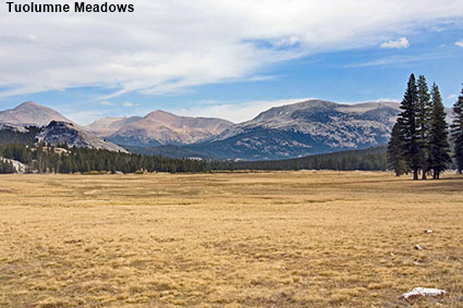
Tuolumne Meadows
Away from the crowded valley up the road to the Tioga Pass can be found Tuolumne Meadows. For much of the year these high meadows are covered in deep snow and the Tioga Road is closed. It is one of the most attractive parts of the park. but at an elevation of around 2600 metres (8600 feet) the climate here can be harsh. Click Tab 2 to see the highest point on the Tioga Road, the Toiga Pass Park Entrance at an elevation of 3,031 metres (9,945 feet).
Yosemite National Park
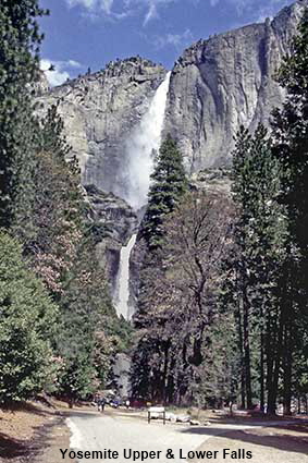
Yosemite Upper & Lower Falls
Yosemite is famous for its waterfalls but during our first visit to the National Park in October 1981 we found them extremely disappointing. Being British we were used to waterfalls that flow all year round, but the falls in Yosemite are fed primarily by melting snow so all there was to see at that time of year was a slight damp patch running down the cliff face. However, in the spring the falls well and truly live up to their reputation. This photograph was taken in May 1995 when the Yosemite Upper & Lower Falls were at their peak.
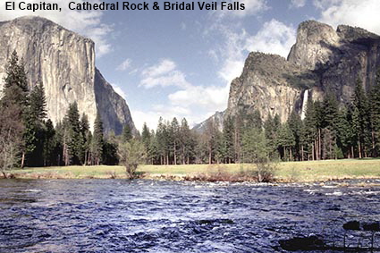
El Capitan, Cathedral Rock & Bridal Veil Falls
The Yosemite Valley is the most crowded part of the National Park and in some areas it can be difficult to see the scenery without hordes of people in view. This photograph shows a people-free view of the valley with on the left the sheer walls formed by El Capitan and on the right the white streak of the Bridal Veil Falls. The cliff face of El Capitan is very popular climbing territory. Click Tab 2 to see a picture of climbers on El Capitan.
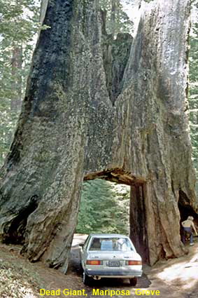
Dead Giant, Tuolumne Grove
Giant Sequoia trees are covered in more detail on our page on Kings Canyon & Sequoia National Park. These trees grow trunks of such a huge diameter that a tunnels can be carved through them that are big enough to drive cars through. Such tunnels became popular in the 19th century but cutting a tunnel through the trunk weakens the tree and eventually causes its death so no tree tunnels are now cut in National Parks. This tree had a tunnel carved through it in 1878 and although it subsequently died we were still able to drive a car through the stump back in 1981. Nowadays cars are not allowed to drive to Tuolumne Grove and we were told by a ranger that this stump had fallen. For a close up view of Giant Sequoia you can still drive to Mariposa Grove. Here once stood the most famous drive-through tree, the Wawona Tree, but it collapsed under the weight of snow in 1969. When we visited in 2009 Mariposa Grove still had a tunnel tree, but the tunnel through the California Tree is open only to pedestrians. Click Tab 2 to see the California Tree in Mariposa Grove.
Click on Minimap to navigate
Home > US States > The West > California >
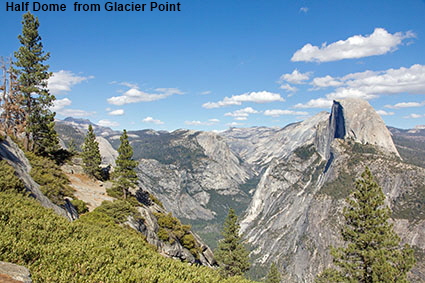
Half Dome from Glacier Point
We only got to see this spectacular view across the valley for the first time in 2009. On our 1981 trip to the park we did not have enough time to take the 50 kilometre (31 mile) round trip and our 1995 trip was in the spring before the Glacier Point Road had opened for the season. The view from Glacier Point is breathtaking, so if you are visiting at a time of year when the road is open do make enough time for the trip. This picture shows the view up Tenaya Canyon with Half Dome just to the right of the canyon. Click tab 2 to see a picture looking down into Yosemite Valley from Glacier Point.
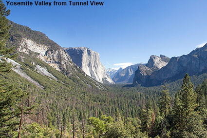
Yosemite Valley from Tunnel View
Yosemite Valley has steep sides and the roads approaching the valley from both the South and Big Oak Flat entrances have to go through tunnels. On coming out of the tunnel on the road from the South Entrance you are rewarded with a clear view (weather permitting) right up the valley. On the downside, Tunnel View is one of the most crowded locations in the valley. Click Tab 2 to see the crowds.


To move forwards or backwards through the California trail click the arrows above, or select your next destination on the Minimap.
DLU181122


© Mike Elsden 1981 - 2025
The contents of this page may not be reproduced in full or in part without permission
