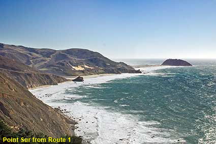
Point Sur from Route 1
A large volcanic rock sticking out into the Pacific adds drama to the view and it is also a major hazard to navigation. Thus in 1889 a lighthouse was opened atop the 110 metre (361 foot) high rock known as Point Sur. The rock is connected to the mainland by a spit of land, but before the Cabrillo Highway was built is was easier to supply the lighthouse by sea. The lighthouse and its ancillary buildings are now a California State Historic Park. The light still functions, having been automated in 1974.
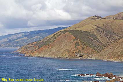
Big Sur coast near Lucia
This view near Lucia shows the typical features of the Big Sur coast, mountains tumbling down to a turbulent ocean. In this picture the Cabrillo Highway crosses a steep sided valley via Big Creek Bridge which is just visible near the end of the valley. This section of coast was undeveloped before this part of the Cabrillo Highway was completed in 1937 and even now it is largely unspoiled with only a few small settlements. Click Tab 2 to see another typical view of Big Sur, further south at Willow Creek.
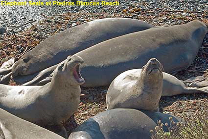
Elephant Seals at Piedras Blancas Beach
The Elephant Seal gets its name from the male of the species who grow pendulous noses that can reach up to 60 centimetres (2 feet) in length. Northern Elephant Seals were nearly driven extinction in the 1880s by shore whalers and sealers hunting them for their blubber. A tiny colony survived on Guadalupe Island, off Mexico’s Baja California. Mexico gave protection to the Elephant Seals and later the US joined in, allowing numbers to increase and their range to extend back up the west coast. This colony on the beach near Piedras Blancas Lighthouse now numbers around 15,000 animals. Click Tab 2 for a view towards Piedras Blancas Lighthouse.
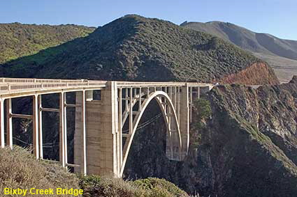
Bixby Creek Bridge
Bixby Creek Bridge can not rival the scale and elegance of California’s best known bridge, the Golden Gate. However it does have a dramatic location by the coast spanning a deep ravine. Completed in 1932 this single arch bridge is built of concrete and with a span of 97 metres (320 feet) it was at the time one of the largest of its kind in the world. This classic view of the bridge was taken in 2007 from a parking lot just north of the bridge.
Big Sur
Big Sur is the coast between Carmel Highlands and San Simeon, although nowadays the name is often loosely applied to the much of the coastal route between San Francisco and Los Angeles. The true Big Sur is a 140 kilometre (88 mile) stretch of wild coast that has been little developed apart from the construction of the Route 1 Cabrillo Highway that runs along it often high above the ocean. It is one of the best coastal drives in the world alongside the Amalfi corniche road in Italy and the Cabot Trail in Nova Scotia. It is best driven from North to South so that you are on the seaward side of the road to stop at viewpoints. If, however, you suffer from vertigo you may prefer to travel in the other direction.
DLU181211
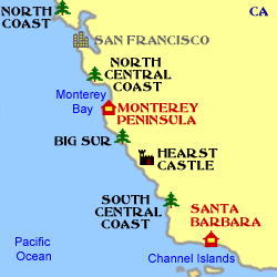
Click on Minimap to navigate
Home > US States > The West > California > Californian Coast >
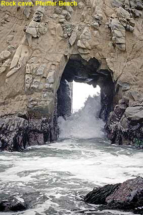
Rock cave, Pfeiffer Beach
Big Sur is all about rocks, sand and the ocean and here at Pfeiffer Beach all are present and correct. The Pacific rollers crash through a rock cave, but there are also long stretches of sandy beach. The beach is named after John and Florence Pfeiffer who ranched inland from here. They let visitors stay at their ranch initially for free, but in time it grew into a substantial business and Pfeiffer Ranch Resort was born. In 1933, the Pfeiffer's gave some of their ranch land to the State of California and this land is now part of Pfeiffer Big Sur State Park, an inland park of trees and meadows. The Big Sur Lodge now stands on the site of the Ranch Resort.
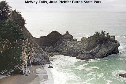
McWay Falls, Julia Pfeiffer Burns State Park
A small waterfall pours over a cliff down a 24 metre (80 foot) drop onto a pristine beach. The beach is pristine because there is no trail down to it, not just to preserve it but also because the sea currents here are treacherous. Although there is no beach access at Julia Pfeiffer Burns State Park, there is a short trail from the top of the falls along McWay Canyon to another waterfall.


To move forwards or backwards through the California Coast trail click the arrows above, or select your next destination on the Minimap.

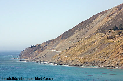
Landslide site near Mud Creek
On May 20, 2017 a massive landslide of more than 6 million tonnes destroyed around 0.4 kilometres (0.25 miles) of Route 1 just south of Gorda. Landslides are not uncommon along Big Sur but the size of this one was exceptional and it occurred at a time when Route 1 was already closed 48 km (30 miles) further north where the Pfeiffer Canyon Bridge was having to be be replaced following a February landslide. Suddenly, the only access to the central section of Big Sur was via a narrow and difficult mountain road and it was not until the new Pfeiffer Canyon Bridge opened in October 2017 that access from the north was restored. It was forecast that it would take 16 months to rebuild the road at the Mud Creek landslide, meaning that the Big Sur tourist route would have been closed to through traffic for 22 months. Fortunately the work was completed two months ahead of schedule and traffic was once again able to drive the whole route from July 18, 2018. We drove the reopened Route 1 in mid October 2018. Click Tab 2 to see the same view in January 2007.
© Mike Elsden 1981 - 2025
The contents of this page may not be reproduced in full or in part without permission