Nova Scotia
While Québec Province retains the most visible signs of the French influence in Canada the French first arrived in the Bay of Fundy, the large bay that almost cuts off modern day Nova Scotia from New Brunswick. In 1605 the French set up a settlement at Port-Royal in what is now Nova Scotia. However, Britain also had plans for the area and soon it was sending settlers from Scotland. The territory changed hands several times until the 1763 Treaty of Paris gave the area to Britain. The British expelled the French Acadians but some later returned creating a rich culture with strong Scottish and French flavours.
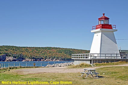
Neil's Harbour Lighthouse, Cape Breton
Nova Scotia’s crown jewel is its coast. With the exception of the Bras d’Or lakes on Cape Breton Island, inland Nova Scotia is pleasant but unspectacular. The rugged and deeply indented coastline more than makes up for that. Along with such a coastline come lighthouses galore, in all shapes and sizes. By the end of your trip to the Province, you will find that you are at risk of lighthouse overload. Here at Neil’s Harbour in the north of Cape Breton Island a simple square lighthouse overlooks the bay, with the trees in the background beginning to show their autumn colours.
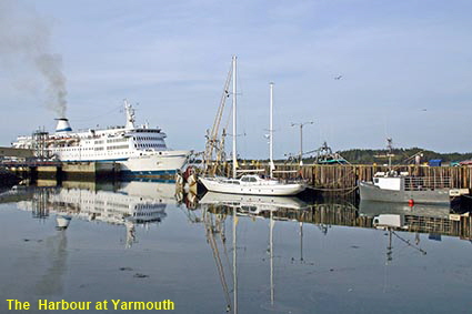
The Harbour at Yarmouth
Situated near the southern tip of Nova Scotia, Yarmouth is the gateway for many visitors from the USA. Ferries from Portland and Bar Harbor in Maine. The ship in this picture is believed to be the Scotia Prince which sailed between Portland and Yarmouth until in 2004 dangerous levels of toxic moulds were found in the Portland International Marine Terminal. The resultant dispute with the owners of the terminal left the ferry with no facilities in Portland thereby putting the Scotia Prince out of business. Another company still operates a high speed catamaran service on the route.
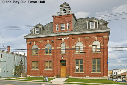
Glace Bay Old Town Hall
Coal was king in the area around Sydney and Glace Bay on Cape Breton Island. Built in 1902 Glace Bay Town Hall continued in service until 1987. In 1989 it was converted into the Glace Bay Heritage Museum. Like many small local museums, it provides a real insight into the history of the area, and we found the friendly museum staff only to happy to tell the story. The nearby Cape Breton Miners Museum provides a more structured insight into the history of mining in the area, and a tour of a real mine is also available.
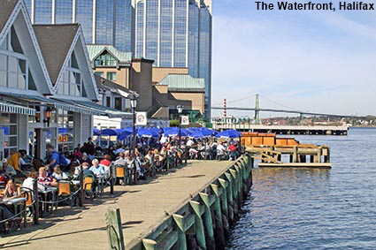
The Waterfront, Halifax
Halifax sits on the southern shore of a fjord that forms its sheltered natural harbour. On the opposite side of the harbour stands the town of Dartmouth, now linked to Halifax by two bridges as well as a ferry. The city started as a British settlement set up in 1749 to defend British interests against the French who were then based in Cape Breton Island. Now the provincial capital of Nova Scotia, Halifax is a pleasant city with a lively waterfront. This picture shows a busy waterfront restaurant with the outdoor tables pretty full. Nothing unusual for Halifax at the height of summer, but this picture was taken on October 9th.
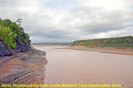
River Shubenacadie from South Maitland Tidal Observation Deck
The Bay of Fundy is renowned worldwide for one thing - its abnormally high tidal range. In the Minas Basin at the eastern end of the bay, the average tidal range is 12 metres (40 feet) and it can be as much as 16 metres (52 feet). The River Shubenacadie flows into the Minas Basin and at certain times the rising tide can send a tidal bore up the river; a wave of water that temporarily reverses the flow of the river. A former railway bridge has been turned into a platform for viewing the tidal bore, but there was no information there to tell us when one might be expected.
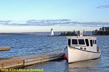
Bras d’Or Lake at Baddeck
The Bras D’Or Lake is an inland lake that has shallow and narrow connections to the Atlantic Ocean. The water in the lake is therefore salty, albeit with a salinity level that is lower than the open ocean. The lake is large, with a surface area of around 930 square kilometres (360 square miles) and it almost cuts Cape Breton Island in two.
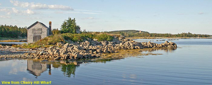
View from Cherry Hill Wharf
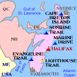
To finish this page, a classic view of Nova Scotia’s coast. A series of drives (or trails) are signposted along the coast, click below to visit some of them. This picture was taken not far from Liverpool on the Lighthouse Trail, but tranquil views like this can be found all around the coast.
Home > Oh! Canada > Maritime Provinces >
Click on Minimap to navigate
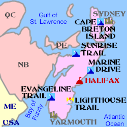


We have more pages on Nova Scotia. Click below or on the Minimap:
DLU060522
© Mike Elsden 1981 - 2023
The contents of this page may not be reproduced in full or in part without permission