Home > Oh! Canada > Maritime Provinces > Nova Scotia >
The north eastern end of Nova Scotia is an island separated from the mainland by a narrow channel. Cape Breton Island became permanently attached to the mainland when the Canso Causeway was built in 1955, but historically it has at times been separated from the rest of Nova Scotia. The French settled it as part of Acadia and called it Île Royale. When Britain took control of mainland Nova Scotia in 1713, Île Royale and Île St Jean (Prince Edward Island) remained under French control. The 1763 Treaty of Paris gave the whole area to Britain and in 1784 Cape Breton Island became a colony in its own right. It finally merged with Nova Scotia in 1820.
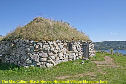
The MacCallum Black House, Highland Village Museum, Iona
During the Highland Clearances the Scottish Highlands were forcibly depopulated to make room for sheep. Emigration was the main option for displaced Higlanders and in the early 19th century many settled in Cape Breton Island. They brought with them their Gaelic language, their traditions and their style of buildings. The Highland Village Museum has been set up on a site overlooking Bras d’Or Lake to preserve the buildings and culture of the Highland settlers. The MacCallum Black house shown here is typical of the houses that they would have occupied in Scotland in the late 18th century. Click Tab 2 to see the Malagawatch United Church built in 1874.
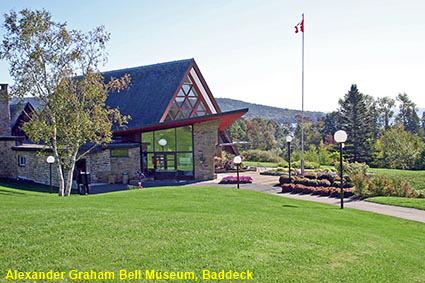
Alexander Graham Bell Museum, Baddeck
Ask an American the nationality of Alexander Graham Bell and they will say he was American, ask a Scot and he will say he was from Scotland. Both are technically right, but why is the inventor of the telephone celebrated here in Cape Breton Island? Bell emigrated to Canada before he went to the USA and never forgot his Scottish roots so he set up his summer home Beinn Bhreagh near Baddeck in the Gaelic area of Cape Breton Island. In addition to the telephone, Bell worked on many other inventions including hydrofoils and aids for the deaf. Much of his work was done at Beinn Bhreagh and in 1922 he was buried atop nearby Beinn Bhreagh mountain. The Alexander Graham Bell Museum at Baddeck provides a fascinating insight into his life and work.
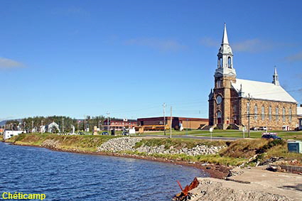
Chéticamp
Having looked at the Scottish side of Cape Breton Island, now it is the turn of the French-speaking Acadians. Chéticamp is a fishing town founded in 1785, after Cape Breton Island had become British territory. Many of the people who settled here were Acadians who had been deported by the British but were subsequently allowed to return. Apart from fishing, the town is now famous for ‘Rug Hooking’, wool or rag rugs made on a base of burlap.
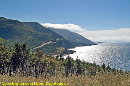
Cape Breton coast from Cap Rouge on the Cabot Trail
In 1936 the Canadian government established the Cape Breton Highlands National Park, covering an area of 950 square kilometres (366 square miles) of the northern peninsula of Cape Breton Island. The most famous trip on Cape Breton Island is the Cabot Trail, a scenic highway that encircles the coastal perimeter of the Cape Breton Highlands plateau. Nearly 300 kilometres (180 miles) in length it offers some spectacular views comparable with the Big Sur in California.
Click on Minimap to navigate
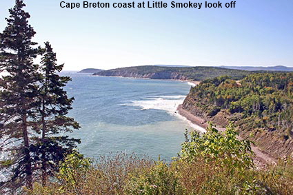
Cape Breton coast at Little Smokey look off
Cape Breton Island may be linked to the mainland by the Canso Causeway, but it still has a different feel from the rest of Nova Scotia. In the early 19th century there was an influx of gaelic speaking Scottish Highlanders made homeless by the clearances. They must have felt at home with the indented coastline and inland lakes similar to Scottish sea lochs, but don’t expect to find mountain scenery to rival the Scottish Highlands. The French speaking Acadians also still have a strong presence as this was still Île Royale under French control at the time of the expulsion of Acadians from the rest of Nova Scotia.
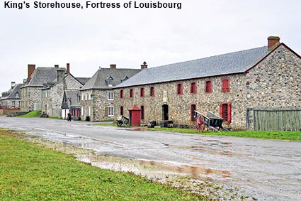
King's Storehouse, Fortress of Louisbourg
After the 1713 Treaty of Utrecht ceded mainland Acadia to the British the French decided that they needed to improve the defences of Île Royale. From 1719 they built a fortified town at Louisbourg but construction was slow and it had barely been finished when in 1745 Britain and France were at war again and Louisbourg was captured by New Englanders. It was returned to the French within 4 years but in 1758 the British took to fort for a final time and destroyed the walls. The Fortress of Louisbourg that you now see is a reconstruction started by the Canadian Government in 1961. Costumed rôle players help you to understand what life was like in the French era. Click Tab 2 to see the Dining Room in the Governor's Quarters.
Cape Breton Island


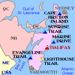
To move forwards or backwards through the Nova Scotia trail click the arrows above, or select your next destination on the Minimap.
DLU060523

© Mike Elsden 1981 - 2023
The contents of this page may not be reproduced in full or in part without permission