Canyonlands National Park
Travelling upstream from the Grand Canyon the Colorado River enters Utah where it eventually splits in two with the Colorado River to the east and the Green River to the west. Both rivers run through deep canyons and for the first 30 kilometres (20 miles) the two rivers run close to one another. The mesa top between the rivers provides spectacular views to the west across the Green River and Stillwater Canyon to the east views across the Colorado River and Meander canyon and also to the south where the rivers meet. Because of its elevated views the mesa top was given the name ‘Island in the Sky” and in 1964 the area became Canyonlands National Park.
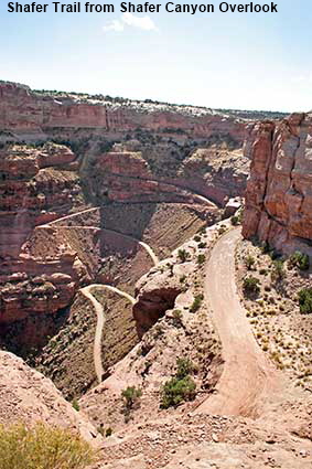
Shafer Trail from Shafer Canyon Overlook
This steep and winding gravel road climbing up to the mesa top from Moab is the route that Microsoft Streets & Trips mapped for us to take to and from the park in our rental car. Mr Gates please note, the Shafer Trail is recommended for 4 Wheel Drive vehicles only and there is a perfectly good surfaced (paved) road into the park from the north. The drop below the Shafer Trail is long and steep so even in a 4WD the journey can be scary for those who lack a head for heights. Plenty of people were trying the Shafer experience in their 4WDs, all going in the recommended uphill direction. For movie fans the trip is worthwhile as it was from Shafer (not the Grand Canyon) that Thelma & Louise took their final plunge.
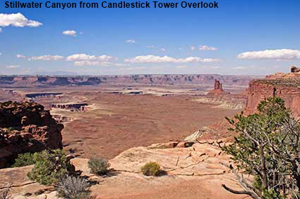
Stillwater Canyon from Candlestick Tower Overlook
The White Rim is 365 metres (1200 feet) below Island in the Sky and in places it is so wide that the lower part of the canyon is barely visible. Here the cliffs of the upper part of the canyon have eroded leaving behind the distinctive Candlestick Tower.

Canyonlands from Grand View Point
Grand View Point Overlook is the most southerly point on the Park road giving views over the area where the deep canyons cut by the Colorado and Green Rivers meet up. The canyon extends almost as far as the eye can see and a double rainbow adds atmosphere to an already dramatic view. This picture was taken during our first visit to Canyonlands National Park back in 1988. At the overlook we encountered a Welsh speaking tourist, and Jen had her first opportunity in the USA to converse in her first language.

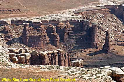
White Rim from Grand View Point Overlook
The white limestone of the White Rim stands out best close to the edges of the lower part of the canyon, where erosion has removed the soil. The contrast between the white limestone and the dark walls of the lower part of the canyon serve to highlight the geology.

DLU051026
Click on Minimap to navigate


To move forwards or backwards through the Utah trail click the arrows above, or select your next destination on the Minimap.

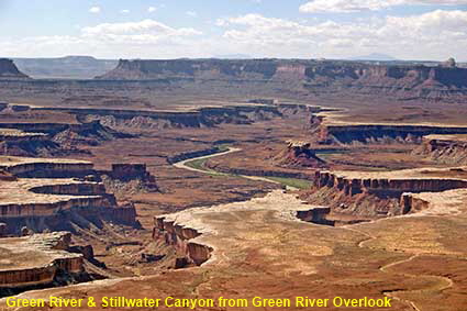
Green River & Stillwater Canyon from Green River Overlook
The canyons here are not as deep as the Grand Canyon, with the rivers only 670 metres (2200 feet) below the rim. Although not so deep they are very, very wide and the rivers are glimpsed only in the distance. Not only does this picture show the Green River but it also shows the structure of Stillwater canyon. A layer of hard white limestone for a time arrested the deepening of the canyon. When the river eventually broke through the white limestone it created a ‘canyon within a canyon’. The flat area capped with white limestone is called the White Rim.

© Mike Elsden 1981 - 2025
The contents of this page may not be reproduced in full or in part without permission

