Arches National Park
Rock arches are not unusual across the wide expanses of the USA, but in this small area with there are over 2000 natural arches. The reason why there are so many here lies in the rocks. The red sandstone erodes to form vertical blades of rock. The rock in the lower parts of these blades is softer than the rock at the top, so in places the lower rock has weathered through, leaving an arch. Of course the arch will eventually collapse, leaving the pinnacles and balanced rocks that also abound in the area. The first recorded visit to the area was by a French trapper in 1844 who carved his name in the rock. Protected as a National Monument since 1929, the area became a National Park in 1971.
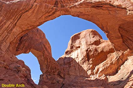
Double Arch
This pair of arches has to be seen from close up as from the road the sky is not visible through the arches. If you park in the right place the round trip is only 1.2 kilometres (0.8 mile) along an easy trail.
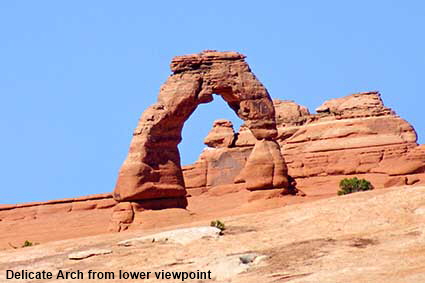
Delicate Arch from lower viewpoint
The most photographed arch is undoubtedly Delicate Arch, a semi-circle of rock standing on its own. Originally a fin of rock, its centre has weathered away to create this distinctive shape. The best view of the arch is from the other side where it can be seen against the backdrop of the La Sal mountains. The walk to see this view can take over three hours over open rock with little shade. In 1988 a fierce thunderstorm ruled it out and in 2005 we decided that in the hot weather the walk to Landscape Arch was preferable to taking the exposed uphill route to Delicate Arch.
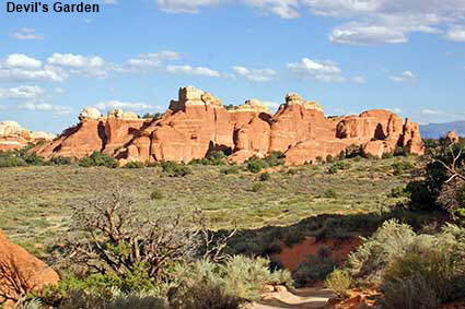
Devil's Garden
Trails starting at the northern end of the park road take you into the Devils Garden area. Here you see the vertical blades of sandstone thrusting out of the ground and every so often you are rewarded with a view of an arch. A good trail takes you the 2.6 kilometre (1.6 mile) to Landscape Arch, and short side trips will also take you to Pine Arch and Tunnel Arch. For dedicated hikers there are rough trails that will take you to many other arches.
Landscape Arch
Although Delicate Arch is the best known arch in the National Park, Landscape Arch is more spectacular. It has an 88 metre (290 feet) span yet Landscape Arch is only 2 metres (6 feet) thick at its narrowest point. This picture was taken in 1988 when it was possible to get right under the arch. In 1991 a slab of rock fell from the side of the arch and since then the area under the arch has been cordoned off. Whether one rock fall means that the risk of injury here is any greater than under other arches is debatable. Of course one day the arch will fall, but it was still defying gravity when we revisited in 2005.

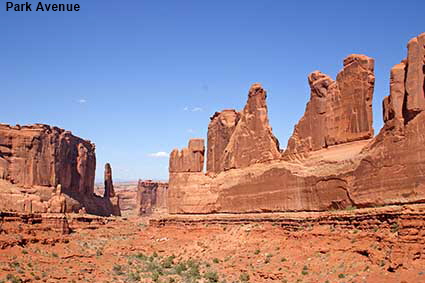
Park Avenue
With ‘Skyscrapers’ of sandstone along each side this canyon was named after Park Avenue in New York. We have to say that there is much less traffic here and the air is a lot cleaner. One day there may be arches in the side of this canyon. The rock at the top is solid, but cracks can be seen in the rock at the bottom. This is high desert, typically 1500 metres (5000 feet) high, with a very wide temperature range. Water getting into the cracks in the lower rocks will freeze during cold nights breaking off bits of the rock. One day erosion from one side will meet erosion from the other and a new arch will be formed.
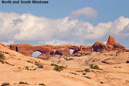
North and South Windows
You can walk right up to the North and South Windows, but a rock a outcrop between them means that you can only see both of them from afar. There is a third arch just visible on the right of this picture, immediately to the left of a dark rock is a sliver of light which is coming through Turret Arch.
DLU051024
Click on Minimap to navigate


To move forwards or backwards through the Utah trail click the arrows above, or select your next destination on the Minimap.


© Mike Elsden 1981 - 2025
The contents of this page may not be reproduced in full or in part without permission