Zion National Park
Arches to Zion - Utah can claim to have an A to Z of National Parks, even if most of the letters in between have been missed out. Zion canyon is a sandstone canyon formed by the North Fork Virgin River. In the 1860s Mormons moved from Salt Lake City to settle southern Utah. They established the town of Springdale at the entrance to the canyon and some set up homesteads in the canyon. They named the canyon Zion after the ancient Hebrew word for sanctuary or refuge. In the early 20th century the scenic beauty of the canyon was recognised. Roads were built to provide access and in 1919 the canyon became a National Park.
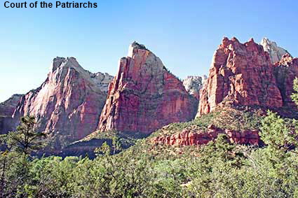
Court of the Patriarchs
These three sandstone towers are near the southern end of the scenic drive up the canyon. They were named The Patriarchs in 1916 after Abraham, Isaac, and Jacob from the Bible by Methodist Minister Frederick Vining Fisher. In Fisher’s day the canyon would have been very quiet, but now it is suffering from visitor overload. Private cars are no longer allowed on the scenic drive between late March to the end of October, instead a free shuttle bus stops at certain points along the drive. Back in 1988 we drove up the canyon and could stop where we wanted.
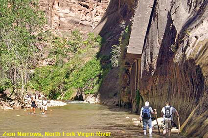
Zion Narrows, North Fork Virgin River
A scenic drive runs up Zion Canyon to an area called the Temple of Sinawava. From there a trail continues up the canyon to Zion Narrows, where the Zion becomes a slot canyon with North Fork Virgin River occupying the whole of the canyon floor. In places the canyon walls are only 6 metres (20 feet) apart. The only way to continue is to wade through the river as some hardy walkers are doing in this picture.
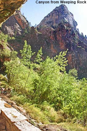
Zion Canyon from Weeping Rock
Even at the low resolution used on the Internet it is possible to see water droplets in this picture against the dark rock of the canyon wall. This is water that collected in a higher slot canyon which has seeped into the rock. Due to a layer of impermeable shale the water emerges in the cliff face some way above the canyon floor and it rains down on any tourists walking close to the canyon wall. The the cliff is undercut here which provides a dry area to take in the view, but the entry to and exit from the viewpoint are distinctly wet.
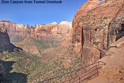
Zion Canyon from Tunnel Overlook
The road to the east of the Zion turns up Pine Creek canyon and zig-zags up the canyon wall before disappearing into a 1.8 kilometre (1.1 mile) long tunnel. At the eastern end of the tunnel there is a trail that takes you to this viewpoint overlooking Zion Canyon (in the distance) and Pine Creek Canyon. Part of the road leading up to the tunnel is visible in the bottom left of the picture.
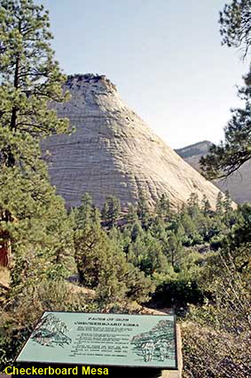
Checkerboard Mesa
Close to the Route 9 near the eastern edge of the park is this unusual rock. It is not the vibrant red/orange colour of most rocks in Zion and is covered in horizontal and vertical cracks in a surprisingly regular pattern. The horizontal lines were formed by wind blown sand from ancient giant sand dunes that once covered this area. The vertical cracks are more recent, the result of cracking in the brittle rock. They have been widened over the years by a freeze/thaw process and hence the checkerboard effect most visible on the north face where the ice lingers longest.
DLU051101
Click on Minimap to navigate


To move forwards or backwards through the Utah trail click the arrows above, or select your next destination on the Minimap.


© Mike Elsden 1981 - 2025
The contents of this page may not be reproduced in full or in part without permission
