Pittsburgh
At the point where the Allegheny and Monongahela rivers merge to form the Ohio River stands a city that in the US is synonymous with heavy industry. Pittsburgh was named in 1758 after Sir William Pitt and an early industry in the town was boat building. The war of 1812 between the USA and Britain created a shortage of manufactured goods and soon Pittsburgh was a centre for production of iron, brass, tin and glass products. In the 1830s many people from South Wales brought their steel producing skills to Pittsburgh and by the time of the civil war the city was a centre for manufacture of armaments. Come the end of the 19th century it was the largest centre for steel production in the USA. The steel industry began to shrink in the 1970s and now Pittsburgh’s economy is largely based on services and high technology.
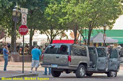
Movie shoot, Market Square
This picture of a car riddled with bullets is the one that we show British friends who believe that the US is a dangerous, gun-toting society. In reality we didn’t stumble on a shoot out in downtown Pittsburgh, by chance our visit coincided with a movie shoot in Market Square. We didn’t find out the name of the movie, so if anyone recognises the scene or knows what was being shot in Pittsburgh on May 23, 2007, please e-mail us.
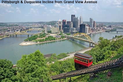
Pittsburgh & Duquesne Incline from Grand View Avenue
Pittsburgh is best known as ‘Steel City’ but it is also known as the ‘City of Bridges’ courtesy of the downtown area (or ‘golden triangle’) having rivers on two of its three sides. The tip of the point where the Allegheny and Monongahela rivers merge was occupied from 1754 by the French Fort Duquesne, replaced in 1758 by by the British Fort Pitt. The site is now Point State Park, but only the blockhouse building and some foundations remain of Fort Pitt. In the foreground is the 1877 Duquesne Incline, one of two funiculars that climb up the steep riverbank.
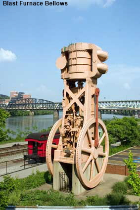
Blast Furnace Bellows
There are many reminders of Pittsburgh’s past as ‘Steel City’. Here, just beside the approach to Smithfield Street Bridge, bellows used to ventilate a blast furnace have been preserved. In the nearby Station Square shopping centre a Bessemer Converter is on show. The Bessemer Converter dramatically reduced the cost of steel production. It was invented twice, by William Kelly who was born in Pittsburgh and by Henry Bessemer in England.
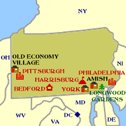
Click on Minimap to navigate
Home > US States > Midatlantic USA > Pennsylvania >
DLU080512
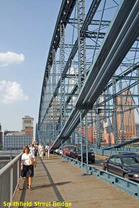
Smithfield Street Bridge
There are also reminders of the ‘Steel City’ days that are still in use. Smithfield Street Bridge crosses the Monongahela River connecting the Downtown area to Monongahela Wharf and the bottom of the Monongahela Incline. It is a steel lenticular through-truss bridge with some wrought iron members and the two spans are each 109 metres (360 feet) wide. It was constructed between 1881 and 1883 by engineer Gustav Lindenthal. The upstream side which was added in 1889 to carry double-tracked trolley lines is now used to carry road traffic across the river in the downtown direction.
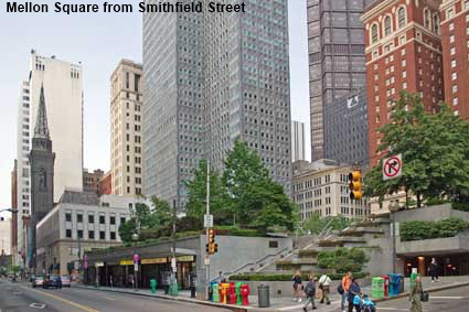
Mellon Square from Smithfield Street,
Mellon Square is named after banker Richard King Mellon who in 1949 proposed a new headquarters for the Aluminium Company of America, instead of a move that they had been considering to New York. Part of his proposal was a public square built on top of a parking garage. Mellon Square opened in 1955 and as the first example of a park built over a parking garage, it is now on the National Register of Historic Places.
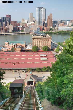
Monongahela Incline
The Monongahela Incline opened on May 28, 1870 and within 25 years there were 17 Inclines (or funiculars) operating in Pittsburgh. Expansion of Pittsburgh had resulted in the development of bluffs overlooking the city. The roads to the top were very poor so the inclines spared the residents a strenuous walk up to their homes as well as carrying light freight. In the first half of the 20th century improved roads resulted in the closure of most of the inclines and in 1962 the Duquesne Incline closed leaving just the Monongahela Incline in operation. A fund raising campaign by residents brought the Duquesne Incline back into service in 1963 and operation of both inclines was taken over by the Port Authority in 1964. The Monongahela Incline is 193 metres (635 feet) long and rises 112 metres (369 feet). the Duquesne Incline is 242 metres (793 feet) long and rises 122 metres (400 feet).


To move forwards or backwards through the Pennsylvania trail click the arrows above, or select your next destination on the Minimap.

© Mike Elsden 1981 - 2025
The contents of this page may not be reproduced in full or in part without permission