North Country & Adirondacks
The highest mountains in New York are found in the north of the state. The Adirondacks are often considered to be part of the Appalachian Mountains that run from Newfoundland in Canada right down to Alabama. However, some geologists consider the Adirondacks to have more in common with the Canadian Shield Mountains than the Appalachians. The highest of the Adirondacks is Mount Marcy at 1,629 metres (5,344 feet) high. There are 43 peaks over 1,219 metres (4,000 feet) high. To the west the mountains give way to gentler scenery as the as the land drops towards the shores of Lake Ontario. This is a largely rural area which may only be 300 kilometres (200 miles) or so in distance from New York City but it feels as though it is light years away from the bustle of the city.
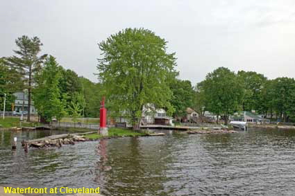
Waterfront at Cleveland
The area between the Adirondacks and Lake Ontario is relatively flat, but not devoid of lakes. Just north of Syracuse is the biggest lake wholly within New York State, Oneida Lake. Because the land is relatively flat the lake is not particularly photogenic, but there are a few pleasant villages in the area. Cleveland stands on the north shore of the lake, and has less than a thousand inhabitants.
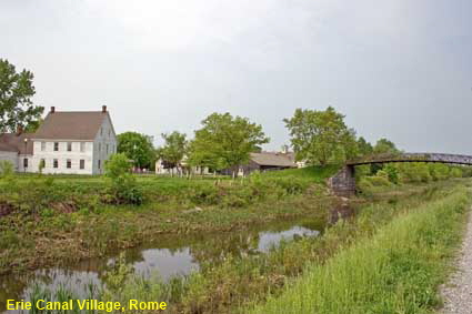
Erie Canal Village, Rome
With the St Lawrence River not then navigable beyond Montréal and its lower reaches passing through British territory, in 1808 plans were drawn up for a canal to link the Great Lakes to the Hudson River. The Erie Canal was built between Albany and Buffalo on Lake Erie, opening in 1825. The New York State Barge Canal replaced much of the route of the Erie Canal in 1918. At Rome, a there is a reconstruction of a 19th century canal-side settlement. Erie Canal Village sits alongside an abandoned section of the original canal. It has three museums and a selection of buildings typical of the era. Unfortunately the village was closed when we passed by, so we were only able to view it from the other side of the canal.
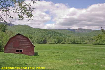
Adirondacks near Lake Placid
More than 24,000 square kilometres (6 million acres) of the Adirondacks has been protected as the Adirondack Park. It is a state park set up in 1892 to control the exploitation of water and timber resources. Around half of the land is owned by New York State, the remainder is privately owned. This view of the Adiirondacks taken just east of Lake Placid is typical of the scenery in the park.
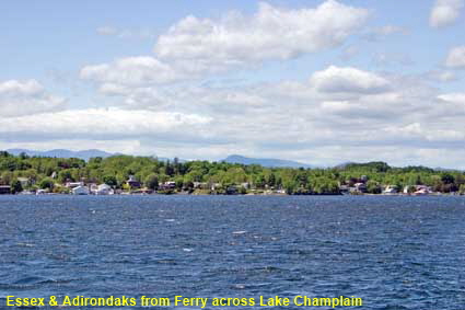
Essex & Adirondaks from Ferry across Lake Champlain
Lake Champlain runs along the northern part of the border between New York State and Vermont, and it also extends just across the Canadian border into Québec Province. Named after French explorer Samuel de Champlain, the lake is 180 kilometres (110 miles) long and up to 19 kilometres (12 miles) wide. There are no bridges across the central part of the lake, so a the way to cross is by ferry. We took the ferry between the towns of Essex, NY and Charlotte, VT. This picture shows the view back to Essex with the Adirondacks looming behind the town.
DLU100518
Click on Minimap to navigate
Home > US States > Midatlantic USA > New York >
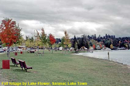
Fall foliage by Lake Flower, Saranac Lake Town
Adirondack Park has thousands of lakes. There are actually three Saranac Lakes, Upper, Middle and Lower. With numerous other lakes in the vicinity Saranac Lake Town is must have been spoilt for choice when deciding which lake to name itself after. Naming itself after the three big lakes in the vicinity was probably a smart move, even if the centre of the town is on the shores of the smaller Lake Flower. Robert Louis Stevenson wrote “The Master of Ballantrae” while spending the winter of 1887/8 here. The town is a major tourist resort and since 2000 has been linked to Lake Placid by the restored Adirondack Railroad.
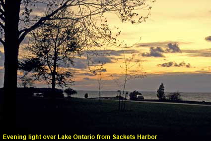
Evening light over Lake Ontario from Sackets Harbor
Sackets Harbor is situated at the eastern end of Lake Ontario, so looking towards the October sunset it is around 300 kilometres (nearly 200 miles) to the next landfall at the western end at Hamilton in Canada. Sackets Harbor was founded in 1801 and courtesy of its natural harbour and proximity to Canada it soon established itself as a trading port. An 1808 US embargo on trade with British Canada turned it into a major centre for smuggling. When the War of 1812 broke out with Britain it became the headquarters for the US Navy on the Great Lakes and a major shipbuilding centre. In the 20th Century it lost its military significance, instead the village is now a tourist centre.


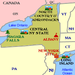
To move forwards or backwards through the New York trail click the arrows above, or select your next destination on the Minimap.

© Mike Elsden 1981 - 2025
The contents of this page may not be reproduced in full or in part without permission