North Coast
The rugged coast of Maine is too extensive to cover in a single page, so we have broken it into three parts. This page covers the northern part of the coast from Bar Harbor to the town of Calais on the Canadian border. The north coast is rugged and isolated, but has fewer fiords and islands that the mid coast area. As you reach the very northern part of the coast, you enter the Bay of Fundy with its spectacular tidal range.
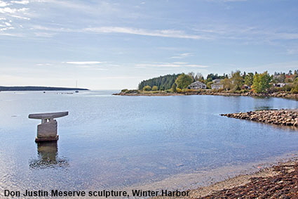
Don Justin Meserve sculpture, Winter Harbor
Winter Harbor was given its name because the harbour does not freeze in winter. This made it a popular port for fishing boats and it still has an active fleet of lobster boats and scallop draggers. The harbour is sheltered from Frenchman Bay by a peninsula called Grindstone Neck, which is a popular summer colony. Don Justin Meserve (1938-2010) was a sculptor based in Maine who was best known for artworks carved in granite and basalt. He completed this sculpture called ‘The Cleat’ during the first international Schoodic Sculpture symposium in 2007 after which it was installed at Winter Harbor.
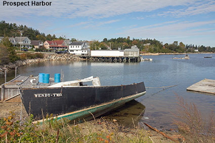
Prospect Harbor
On the eastern side of the Schoodic Peninsula, Prospect Harbor sits at the end of a bay that is split in two by a promontory. The lighthouse that sits on that promontory is cover on the Lighthouses page, but here is a picture of this typical idyllic Maine fishing village.
DLU180324
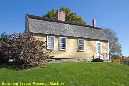
Burnham Tavern Museum, Machias
In colonial times this area was claimed by both Britain and France, but neither counrty paid a lot of attention to the area around Machias Bay. In 1762 people from Scarborough, Maine arrived seeking grass because of drought in southern Maine. Finding marshland with plenty of grass they settled and founded Machias at the head of the bay. In 1775 Machias became the site of the first naval battle of the Revolutionary War. Because of the unrest around Boston, Britain needed timber to build barracks to house troops. HMS Margaretta arrived at Machiasport, 6 km (4 miles) outside Macias. Lieutenant Moore, the commander of the Margaretta, demanded supplies of wood. News of the conflicts at Lexington and Concord only reached Machias via the sloop that accompanied the Margaretta to carry the load of timber. The townsfolk had to decide whether to comply with Lt. Moore’s demand or support the revolution. The debate took place in the Tap Room of Job Burnham’s tavern in the centre of Machias. The townsfolk decided to support the revolution and hatched a plan to kidnap Lt. Moore when he was in church the following day. This failed because Moore saw the band of armed men approaching and escaped back to his ship. The townsfolk commandeered two ships to follow him, and in the battle that followed battle Lt. Moore was fatally shot and the Margaretta captured. The tavern where the townsfolk planned their actions still stands. Burnham Tavern is now a museum dedicated to the Battle of Machias. It opens certain days each week from just after the Independence Day holiday to the beginning of September. We passed through Machias in early October and hence were unable to visit the museum.
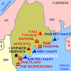
Click on Minimap to navigate
Home > US States > New England > Maine >
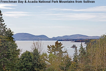
Frenchman Bay & Acadia National Park Mountains from Sullivan
Mount Desert Island is the home of Acadia National Park and it forms the western side of Frenchman Bay. The Schoodic Peninsula forms the eastern side of the bay. The Frenchman that it was named after was explorer Samuel de Champlain who first sailed into the bay and charted it in early September of 1604. This shallow bay is filled with many islands and it used to teem with fish, especially flounder. In recent years the fish have virtually disappeared, and it is thought that this is a result of the destruction of the beds of eelgrass by dragging the bottom of the bay to harvest seafood such as mussels. Scientists have implemented a program to restore the beds of eelgrass, and there are signs that the fish are returning.


To move forwards or backwards through the Maine trail click the arrows above, or select your next destination on the Minimap.
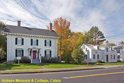
Holmes Museum & Cottage, Calais
Calais is as far as you can go along the coast of Maine, from here three bridges cross the St. Croix River to St. Stephen in New Brunswick, Canada, This area was first explored by Frenchman Samuel de Champlain who spent the winter of 1604 with his men on St. Croix Island. The first settler arrived in 1779 and by 1782 a sawmill had been established. The town was incorporated in 1809 and named Calais in recognition of the help given by France during the Revolutionary War. On Main Street are two historic buildings that are associated with 19th century doctor Job Holmes. The cottage on the right of the picture is thought to have been built in the 1790s. Dr. Holmes was the third doctor to practice from the cottage. He took over in 1846 from his brother-in-law who suffered from health problems. In 1850 when he built the large house next door as his residence and continued to run his practice in the cottage until his death in 1864. The house and cottage are now owned by the St. Croix Historical Society who have restored them to reflect how they would have looked when Dr Holmes was in practice. Holmes Museum and Cottage is open to the public between July 1st and mid September. Click Tab 2 to see the St Croix River at Calais, the border with New Brunswick, Canada
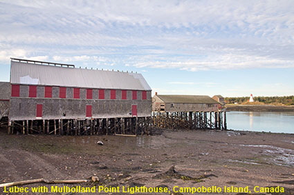
Lubec with Mulholland Point Lighthouse, Campobello Island, Canada
Lubec is the most easterly town on the mainland of the USA. It is so far east that it is almost in New Brunswick, Canada. On the right of the picture is the narrows that separate Canada’s Campobello Island from the USA. The Mulholland Point Lighthouse, visible in the picture, does not qualify for our Maine Lighthouses page because it is firmly in Canada. Turn to look the other way and there is a international bridge linking Maine to Campobello Island. We visited Lubec in early October when it was getting chilly at night and the town was very quiet. Click Tab 2 for a view of Water Street in Lubec.

© Mike Elsden 1981 - 2025
The contents of this page may not be reproduced in full or in part without permission