Dead Horse Point State Park
Heading upstream from Canyonlands National Park the Colorado River continues to wind through Meander Canyon but here the river comes close to the mesa top. Dead Horse Point is part of the mesa top, but it is partially separated by a narrow neck. The steeps sides of the mesa at the point and the narrow neck lie behind its grisly name. In the 19th century, cowboys would round up wild mustangs and Dead Horse Point was an easy place to corral them as they needed only to build a fence across the neck. The name is a result of the cowboys abandoning mustangs that they considered unsuitable for market on the point where they died of thirst within sight of the Colorado River.
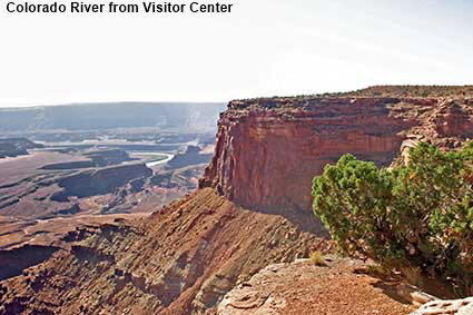
Colorado River from Visitor Center
The Visitor Center is back on the main mesa away from Dead Horse Point. The view of the river as it meanders off to the east is more distant from here.
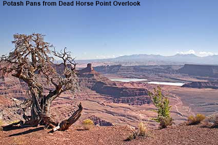
Potash Pans from Dead Horse Point Overlook
A gnarled juniper bush stands guard over the view north east from Dead Horse Point. The mesa top is very dry and hence vegetation is sparse. The Colorado River is now in the distance as it heads east after its pirouette under Dead Horse Point. Potash is still mined west of Moab and the white potash pans stand out against the darker rock.
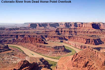
Colorado River from Dead Horse Point Overlook
Although at 600 metres (2000 feet) the canyon is not quite as deep here as at nearby Canyonlands National Park, the drop here is straight down to the Colorado River so it looks much deeper. The 180 degree turn performed by the river underneath Dead Horse Point is the star attraction of the State Park, but we could not find any view point from which the entire curve was visible.


DLU051028
Click on Minimap to navigate


To move forwards or backwards through the Utah trail click the arrows above, or select your next destination on the Minimap.


© Mike Elsden 1981 - 2025
The contents of this page may not be reproduced in full or in part without permission