British Columbia
British Columbia (BC) is the most westerly province of Canada and it shares with Alberta some of the most spectacular mountain scenery along the whole length of the Rockies. It also has Canada’s only Pacific coastline including an Inside Passage sheltered from the ocean by islands. BC’s mix of scenery is bound to leave a lasting impression. Due to the varied climate and terrain the area was originally settled by many different Indian tribes. Russian whalers set up business along the coast and claimed territory as far south as San Francisco, but it was the British who colonised the area. Captain Cook charted the area in 1778 and the first permanent settlers arrived on Vancouver Island in 1843.
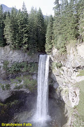
Brandywine Falls
Some 70km (44 miles) north of Squamish and just south of the ski resort of Whistler can be found the Brandywine Falls. The water drops 70 metres (230 feet) over the face of a sheer cliff into a deep gorge creating a waterfall reminiscent of those found in Hawaii.
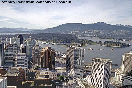
Stanley Park from Vancouver Lookout
Vancouver is Canada’s third largest city and where we first set foot in North America back in September 1981 at the start of our trip down the west coast of Canada and the USA. Even though we have travelled to many other parts of the world since then, we still rate Vancouver’s spectacular location next to mountains and the sea. Of the many places we have visited so far only Cape Town has been able to compete. This view from the Vancouver Lookout shows the tree covered peninsula of Stanley Park which augments the features that you expect to find in a park with a superb display of Totem Poles. You can find out more about the city on the Vancouver page.
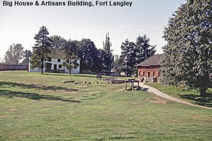
Big House & Artisans Building, Fort Langley
Prior to the first permanent settlement on Vancouver Island, several trading posts were set up. Fort Langley was built on the mainland in 1827 by the Hudson's Bay Company as a fur trading post. Located about 50 kilometres (30 miles) from the mouth of the Fraser River, in 1858 it became a major supply centre following the discovery of gold along the Thompson and Fraser Rivers. 1858 also saw the proclamation of the Crown Colony of British Columbia in the Big House at Fort Langley. The fort was restored in the 1950s and is now a National Historic Site. Click Tab 2 to see the interior of a storehouse.
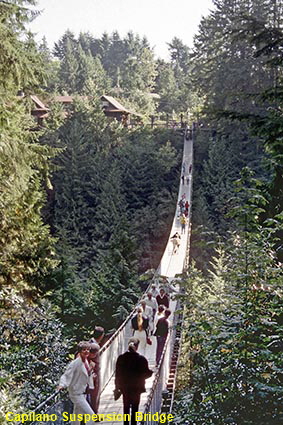
Capilano Suspension Bridge from western side
Welcome to tourist land, BC. The Capilano Suspension Bridge is the most popular tourist attraction in the whole of British Columbia. Its location close to Vancouver on the northern side of Burrard Inlet no doubt helps to bring the crowds. The original hemp rope bridge was built in 1889 by Scottish engineer George Mackay to provide access to his cabin by the canyon. The bridge was rebuilt using wire cables in 1903 and has been rebuilt several times since to carry the load imposed by over 800,000 tourists who visit each year. The bridge is 137 metres (450 feet) long and the walk across is not for the faint hearted, particularly at busy times when it can sway a great deal. The bridge is now the centrepiece of a tourist park with and Adventure Trail, Trading Post and Totem Park.
Home > Oh! Canada > Southwest Canada >
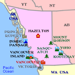
Click on Minimap to navigate


We have more pages on British Columbia. Click below or on the Minimap:
DLU060327
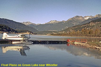
Float Plane on Green Lake near Whistler
This area was once of interest only to trappers loggers and prospectors, who named Whistler Mountain after the shrill whistling sound made by western hoary marmots that live among the rocks. In 1966 the first ski lift opened but when we first visited Whistler in 1981 development as a ski resort had only just begun and the buildings in the small village all looked very new. Nowadays Whistler has grown and it ranks amongst the best known ski resorts world wide. Our visits to the area have been in the autumn and we found that outside of the skiing season Whistler still has plenty to offer in terms of scenery, walks and outdoor activities.
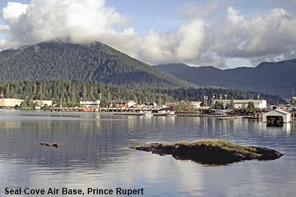
Seal Cove Air Base, Prince Rupert
While Vancouver sits close to the southern border with the USA, Prince Rupert is just south of the northern border with the coastal strip of Alaska. A good harbour and good road link to the interior have made Prince Rupert a significant transport hub with Alaska Marine Highway ferries heading north and the Inside passage ferry heading south. For many years the only air access was by float plane landing here at Seal Cove Air Base. In 1961 a land based airport opened on nearby Digby Island but Seal Cove is still used as a base for float planes.

© Mike Elsden 1981 - 2023
The contents of this page may not be reproduced in full or in part without permission
