Located near the northern edge of the Spanish empire, this area was also subject to Russian & British influence. The story of San Francisco starts with the founding of Mission de los Dolores de nuestro Padre San Francisco de Asis in 1776 (Mission Dolores to its friends). The building of the city (then called Yerba Buena) started in 1835 and despite fires and earthquakes, San Francisco grew in to the attractive and exciting city that it is today.
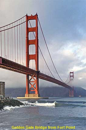
Golden Gate Bridge from Fort Point
You can’t have a page on San Francisco without a picture of its best known bridge. In this picture there is even a patch of the famous Pacific fog across the north tower! San Francisco’s location at the end of a peninsula separating San Francisco Bay from the Pacific meant that it grew up as a city of ferries. In the 20th century bridges replaced the ferries, and although it is not the longest of the Bay Area bridges, the Golden Gate has the most spectacular location and is by far the best known. The bridge took over four years to build and many thought that the winds, fog and strong currents would make it impossible to complete. Opened in 1937, it has a span of 1.28 kilometers (4200 feet) which for 27 years was the world record for a single span.
San Francisco
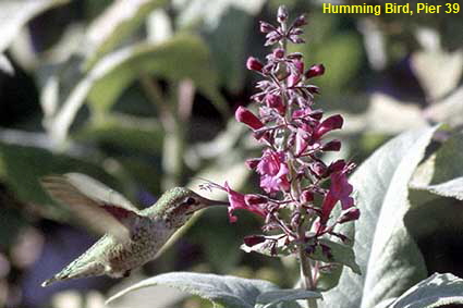
Humming Bird, Pier 39
You could easily believe that this picture was taken somewhere exotic, but in reality is was captured in the middle of San Francisco’s biggest tourist trap. Hummingbirds are found only in North and South America and around the Caribbean. Most live in the jungles of Central and South America, but some species flourish in more temperate climates as far north as southern Alaska. In this picture the Hummingbird is doing what it does best - hovering in the air while it drinks nectar from a flower.
Click on Minimap to navigate
Home > US States > The West > California >
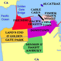
Click on Minimap to navigate
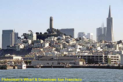
Fisherman’s Wharf & Downtown San Francisco
It is almost impossible not to fall in love with San Francisco. Its location overlooking San Francisco Bay is stunning. Passengers hang on the outside of cute cable cars that clank up impossible hills - the Health & Safety mafia in the UK would never allow that! The Downtown Financial District around Union Square and the tourist centre at Fisherman’s Wharf are linked by cable car and more recently by a vintage streetcar (tram) service. In the centre of this picture taken from the ferry to Alcatraz is the Coit Memorial Tower. It was built in 1933 and provides an excellent view of the bridges, the city and its hills.
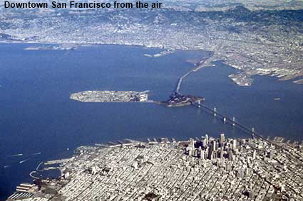
Downtown San Francisco from the air
We don’t often use pictures taken from commercial aircraft as the optical properties of their windows are pretty poor. We have made an exception here because at the bottom of this picture is San Francisco shown with surprising clarity. At the bottom left is the Presidio, then following the coast round you come to the curved piers of the Marina, the straight piers of Fisherman’s Wharf then the skyscrapers of the Financial District in the Downtown area. Cutting across the bay via Yerba Buena Island is the Bay Bridge. Even though the skyscrapers stand out, the picture makes San Francisco look much flatter than it is in reality.
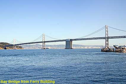
Bay Bridge from Ferry Building
The Bay Bridge spans San Francisco Bay to link the city with Oakland via Yerba Buena Island. This picture shows the western bridge which is a double span suspension bridge. The eastern bridge has a length of 3.1 kilometres (10,170 feet) and is constructed with truss spans. Concerns that the eastern bridge could not withstand a major earthquake were confirmed by the collapse of a span in the 1989 Loma Prieta earthquake. A new eastern bridge is now under construction, but completion is unlikely before 2013.


Click the arrows above to continue on the California Trail. We have other pages on San Francisco. To see them click below or on the Minimap:
DLU070326

© Mike Elsden 1981 - 2025
The contents of this page may not be reproduced in full or in part without permission
