Oahu
Oahu is the third largest Hawaiian island but it is home to over 63% of the population of Hawaii. King Kamehameha I ruled from Oahu after he unified Hawaii in 1810. In 1820 King Kamehameha III made Lahaina on Maui the capital but in 1845 he relocated the capital to Honolulu on Oahu and it has remained the main centre of government ever since. Oahu has the best natural harbour in Hawaii at Pearl Harbor. The Kingdom of Hawaii signed a reciprocity treaty with the USA in 1875 that ceded control of Pearl Harbor to the US in exchange for the US removing duties on Hawaiian raw sugar. The US Pacific Fleet was based at Pearl Harbor when it was attacked by the Japanese in 1941. You will see that Pearl Harbor is absent from the places that we cover. We had planned to go there but the Plantation Village took longer than expected then heavy traffic ensured that it was too late to visit. Next time!
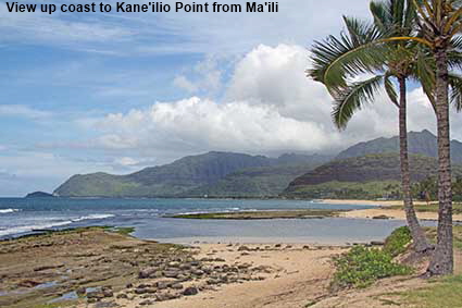
View up coast to Kane'ilio Point from Ma'ili
Route 93 takes you up the west coast towards Kaena Point, the most westerly point of Oahu. Kaena Point is occupied by a Satellite Tracking Station so the road stops short of the point and you have to return back the way you came. Because Route 93 is a road to (almost) nowhere the seaside towns and beaches along it are relatively quiet making it an ideal place to go if you want to escape the ‘maddening crowds’ of Honolulu.
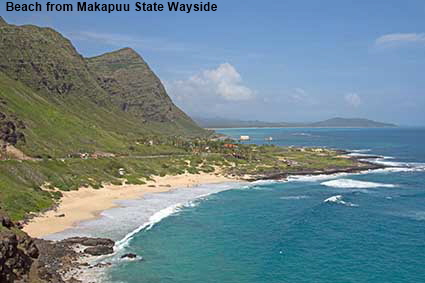
Beach from Makapuu State Wayside
Once you get away from Honolulu you begin to see how all of coastal Oahu once looked - turquoise bays with sandy beaches. Makapuu Point is the most easterly point in Oahu and it has an active lighthouse dating back to 1909. The lighthouse is only accessible by foot. To the west of the point is Makapuu Beach where waves come crashing in from the Pacific Ocean. Due to the waves and currents it is not a beach for swimming but it is popular for bodysurfing and bodyboarding.
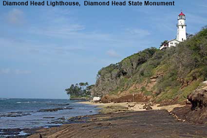
Diamond Head Lighthouse, Diamond Head State Monument
To the south east of Honolulu is a reminder that the origins of Oahu are volcanic. Diamond Head is a volcanic tuff cone, a type of steep sided cone formed when magma comes into contact with large quantities of water. We would have liked to have shown a picture of the cone, but the parking lot at Diamond Head State Monument was full. Instead we had to make do with the coastal area below the cone and distant views of the cone from Route 72. Diamond Head is named after diamonds that sailors believed they had discovered in the rocks of the cone In the 1820s. The ‘diamonds’ turned out to be clear calcite crystals, but the name Diamond Head stuck. Work to build a lighthouse on the head commenced in late 1897. Controversy about the strength of the original iron tower design resulted in the addition of a masonry tower inside the iron tower, so Diamond Head Lighthouse was not lit until July 1899. In 1916 cracks were found in the tower, so the light was placed on a temporary tower while the tower was demolished and replaced by the current concrete tower, which opened in 1918. The light continues to guide ships to Oahu. Click Tab 2 to see a view of the volcanic cone from Route 72.
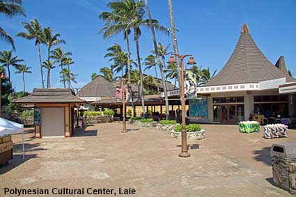
Polynesian Cultural Center, Laie
There are opportunities in Honolulu to attend Hawaiian Cultural shows but the Polynesian Cultural Center just south of Laie aims to provide a comprehensive and authentic experience. You can dine here in a number of dining styles while being entertained with a taste of the culture. There is also a comprehensive evening cultural show. The Cultural Center has showcase villages from six different parts of Polynesia. Sadly, we had not scheduled a stop here so did not have time to explore in detail, next time we will do so.
DLU160722
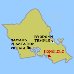
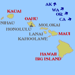
Click on Minimap to navigate
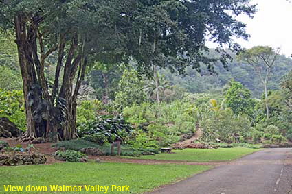
View down Waimea Valley Park
From the bay at Waimea in north west Oahu a valley runs inland passing several ancient Hawaiian archaeological sites to a 14 metre (45 foot) high waterfall. Once upon a time this valley was an adventure park featuring kayaking, exhibitions of cliff diving and hula dancing. Now a Botanical Garden has been created around the archaeological sites in Waimea Valley Park. You can walk through the Botanical Garden for about 1.5 kilometres (1 mile) to Waimea Falls, which are also known as Waihi Falls. Swimming is allowed in the pool at the bottom of the falls. Click Tab 2 to see Waimea Falls.
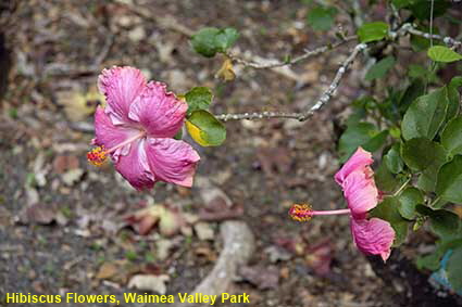
Hibiscus Flowers, Waimea Valley Park
The mix of plants and archaeological sites at Waimea Valley Park creates a unique atmosphere. Here we show some Hibiscus flowers in the park. Click Tab 2 to see the remains of some ancient animal pens.


Click on Minimap to navigate
Click the arrows above to continue on the Hawaii Trail. We have other pages on the Maui. To see them click below or on the Minimap:

© Mike Elsden 1981 - 2025
The contents of this page may not be reproduced in full or in part without permission