Montana
It took us a long time to do justice to Montana. We popped over the border from Wyoming in 1988 and again from North Dakota in 2002, but it was not until 2006 that we really explored the state that is by area the fourth largest. Most of Montana became US territory as part of the 1803 Louisiana Purchase. The eastern boundary of the Purchase was the Mississippi and the western boundary the watershed of its tributaries including the Missouri. Little was known of the of the upper reaches of the Missouri, so in 1805 the Lewis and Clark Expedition set off to explore the area continuing right through to the Pacific coast and returning in 1806. Like its southern neighbour Wyoming, Montana has plains to the east and jagged Rocky Mountains to the west. It has a sparse population with Agriculture, Mining and Timber as its main industries.
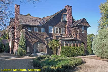
Conrad Mansion, Kalispell
Kalispell is a town north of Flathead Lake that was founded in 1891 when the Great Northern Railroad expanded westwards. One of the founders of Kalispell was Charles E. Conrad who had made a fortune carrying freight in the north west and into Canada. In 1895 he built a mansion in Kalispell where he lived for 7 years until his death in 1902. His daughter Alicia lived in the house until 1964 and in 1974 she gave the mansion to the city of Kalispell in memory of her parents. Now open to the public as the Conrad Mansion Museum, it still has much of its original furniture and provides a real insight into life in the pioneering days of the north west. Click Tab 2 to see the Library & Dining Room
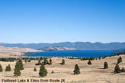
Flathead Lake & Elmo from Route 28
Covering an area of 500 square kilometres (200 square miles), Flathead Lake is the largest lake west of the Great Lakes. It is named after the Flathead (or Salish) Indians who lived in this area. The name derives from the custom of neighbouring tribes of binding babies heads thereby creating pointed heads. The Salish did not have this custom, so they were called Flatheads simply because their heads were normal and not pointed. This picture shows the view down Big Arm Bay to Wild Horse Island.
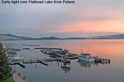
Early light over Flathead Lake from Polson
Situated at the southern end of Flathead Lake, the Flathead Indian Reservation is now the home of the Salish and Kootenai tribes. For tourists Polson is probably the best known town on the reservation. Named after pioneer rancher David Polson, it has a population of around 4,000 and it it sits right on the lake shore. This picture of the first rays of the sun striking the clouds was taken from our motel room.
DLU061114
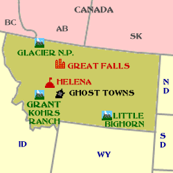
Click on Minimap to navigate
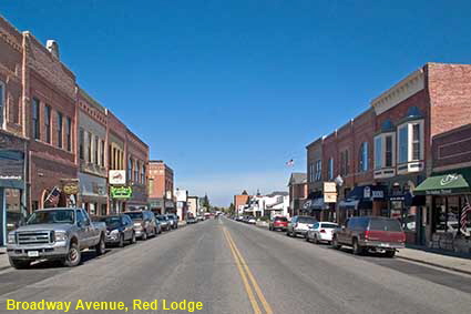
Broadway Avenue, Red Lodge
In the south of Montana close to the border with Wyoming, Red Lodge started life as a coal town. The mines started to decline in the 1920s so the some residents turned to distilling bootleg liquor to augment their incomes. The last mine closed in 1943, but by then the town had another source of income. The Beartooth Highway completed in 1936 runs along the Montana - Wyoming border from Red Lodge to Cooke City, Montana. The highway goes over the spectacular 3337 metre (10,947 feet) high Beartooth Pass and onwards towards the northeastern entrance of Yellowstone National Park. Tourists have replaced coal as Red Lodge’s main industry.
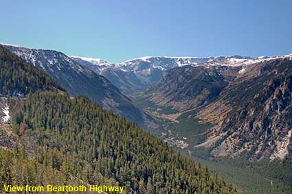
View from Beartooth Highway
The Beartooth Pass has two summits, both of which are located in Wyoming. On the Montana side the is steep and winding as it climbs up the side of the mountain. Viewpoints provide spectacular views of the Beartooth Mountains and the highway winding up the mountainside below.
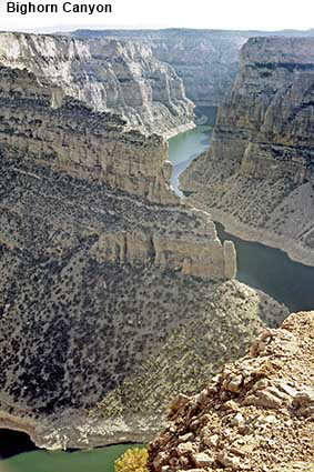
Bighorn Canyon
Although this part of the Bighorn Canyon is in Montana, the only way to get there by road is through Wyoming. The narrow and winding Bighorn Canyon has been partially flooded following the construction of the Yellowtail Dam. Although the bleached rock above the waterline does stand out, the damming of the canyon has not detracted too much from its beauty. The area has been designated a National Recreation Area. It is an area where you have a very good chance of seeing mountian goats. This picture was taken in September 1988 from the Devil Canyon Overlook. Click Tab 2 to see mountain goats near the Devil Canyon Overlook.


We have more pages on Montana. Click below or on the Minimap:

© Mike Elsden 1981 - 2025
The contents of this page may not be reproduced in full or in part without permission