Jasper National Park
The Transcontinental Railway made Banff an tourist destination and National Park back in the 19th century. At that time the Rockies further north were mainly the domain Indians and fur traders. Proposals to build the Grand Trunk Pacific Railway thorough the Athabasca Valley resulted in 1907 in the creation of Jasper National Park. The railway arrived at Fitzhugh Station (now Jasper) in 1913. The park is named after Jasper Hawes who from 1817 ran a provisions depot for North West Company which became known as ‘Jasper’s House’. This is the biggest National Park in the Canadian Rockies, a massive 10,878 square kilometres (4,200 square miles) of mountain wilderness filled with wildlife.
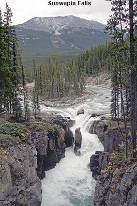
Sunwapta Falls
If you know your geography you will know that glaciers create hanging valleys. At the end of a hanging valley, a high waterfall plunges over the edge into the deeper valley. That’s the theory, but here the river running down the smaller "hanging" Chaba Valley has carved a deep limestone gorge creating a stepped waterfall down into the larger Athabasca Valley. Sunwapta is a Stoney Indian word for "turbulent river" and a footbridge over the gorge provides an excellent viewpoint to see the turbulence as the water descends over the Sunwapta Falls into the gorge.
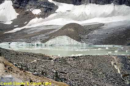
Cavell Glacier & Cavell Lake
Mount Edith Cavell was named in 1916 after a British nurse who was executed in 1915 for helping 200 or more World War 1 prisoners of war to escape from German-occupied Belgium. The mountain is 3363 metres (11034 feet) high and to find a major mountain named after someone from such recent history brings home the fact that even in the early 20th century much of this area was wild and relatively unexplored. High up on the mountain is the Angel Glacier, and below it the rock-strewn Cavell Glacier and Cavell Lake.
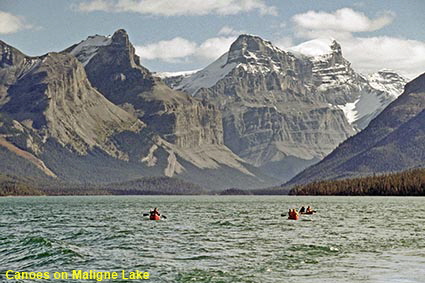
Canoes on Maligne Lake
The first known European visitor to Maligne Lake was railway surveyor Henry MacLeod in 1875, looking for a route for the Transcontinental Railway. He found no eastern exit from the valley, so he had to trudge all the way back. Unsurprisingly he dubbed the lake "Sore Foot Lake". The area was explored in more detail in 1908 by Quaker Mary Schäffer from Pennsylvania. Although Jasper National Park is big, this part of the park does get quite busy. Unlike most lakes in the park, Maligne Lake is home to a lot of commercial activities. Most popular are the cruises to Spirit Island, but you can also go fishing or rent a canoe. In this picture some canoes are dwarfed by the surrounding mountains.
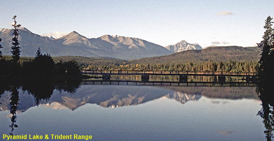
Pyramid Lake & Trident Range
Another of those marvellous mountain lake reflections for which the Canadian Rockies are famous. Petrol (gas) and diesel driven boats are banned from Pyramid Lake, which helps to keep its surface unruffled. In this panoramic picture, the bridge to Pyramid Island is can be seen crossing the lake below the mountains of the Trident Range.
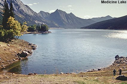
Medicine Lake from western end
Although it can’t quite match the breathtaking scenery of nearby Maligne Lake, Medicine Lake has a fascinating secret. During early summer the lake is 9 kilometres (5.5 miles) long and 30 metres(100 feet) deep. However, water drains from the lake underground, so the level of the lake varies from season to season and it has been known to dry up completely. The local Indians thought that Spirits were responsible for making the water appear and disappear. They referred to it as the ‘Magic Lake’ and the modern name of Medicine Lake has been derived from this.
Click on Minimap to navigate
Home > Oh! Canada > Southwest Canada > Alberta >


To move forwards or backwards through the Alberta trail click the arrows above, or select your next destination on the Minimap.
DLU060412
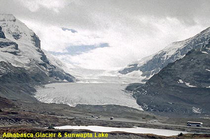
Athabasca Glacier & Sunwapta Lake
The Athabasca Glacier is the best known of the many found in the park, primarily because its terminal is close to the Highway 93 Icefields Parkway. The glacier stretches some 6 kilometres (3.75 miles) down the valley and has a depth of up to 300 metres (1,000 feet). Like most glaciers, Athabasca is retreating and Sunwapta Lake at the bottom of the picture was covered until 1940. The surface of the glacier is very dangerous, but it is possible to go on it either in a special wide-tyred Snowcoach or on foot with a guide. Click Tab 2 to see a closer view of the terminal of the glacier terminal.

© Mike Elsden 1981 - 2023
The contents of this page may not be reproduced in full or in part without permission
