Hawaii Volcanoes National Park
The Hawaiian Islands formed over a hot spot of volcanic activity in the middle of the Pacific Plate. The hot spot is moving very gradually south eastwards so Kauai had active volcanoes six million years ago but now it is the Big Island that has the active volcanoes. Hawaii Volcanoes National Park is centred on Kilauea, a 1,277 metre (4,190 foot) high volcano which first erupted at least 300,000 years ago and has been in a continuous state of eruption since January 1983. Hawaii Volcanoes National Park was founded in 1916 and covers 133,500 hectares (333,000 acres) stretching from the summit of 4,170 metre (13,680 foot) high Mauna Loa volcano to the south east coast of the Big Island. Kilauea is the youngest and most active of the terrestrial Hawaiian volcanoes but already there are eruptions taking place under the sea to the south east of the Big Island which one day will reach the surface of the ocean potentially forming a brand new islands. Kilauea could be described as the world’s only drive through volcano but it is nevertheless very active. The eruption that began in 1983 has produced lava flows covering 111 square kilometres (43 square miles), destroying nearly 200 buildings (including the National Park Visitor Center) and adding new land to the south east coast of the island. The reason why it is possible to get close to the eruption is that Kilauea is not prone to explosive eruptions but hot lava and volcano gases are very hazardous to health so road closures for safety reasons are common.
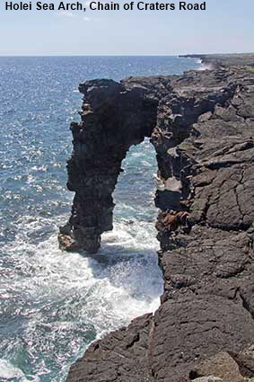
Holei Sea Arch, Chain of Craters Road
Prior to the eruption from the Pu‘u ‘O‘o-Kupaianaha vent, Chain or Craters road continued to the boundary of the National Park and on to Kalapana. When we visited in 2011 the road had reopened to the coast but there was continuing volcanic activity around Kalapana so no effort had been made to rebuild the road across the new lava field. Close to the point where the road was closed is a monument to the combined power of Kilauea Volcano and the Pacific Ocean. Holei Sea Arch is formed from lava that has been sculpted by the sea. While most rock arches many thousands of years old, the 27 metre (90 foot) high Holei arch is less than 100 years old.
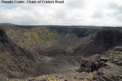
Pauahi Crater, Chain of Craters Road
Chain of Craters Road runs from Crater Rim Drive right down to the coast. Although there was no volcanic activity along the road during our 2011 visit, there was plenty of evidence of previous eruptions, such as sections of the old road disappearing under solidified lava. Pauahi Crater erupted for 31 days in 1973 and 16 days in 1979. The fact that it was peaceful when this picture was taken does not mean that it will not erupt again.
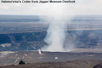
Halema'uma'u Crater from Jaggar Museum Overlook
In the middle of Hawaii Volcanoes National Park is a huge vent of Kilauea volcano. Halema'uma'u Crater is approximately 1 kilometre (0.6 mile) across by 85 metres (280 feet) deep and it contains a lava lake which can be seen glowing at night. When we visited in 2011 it was also emitting a plume of volcanic gas so the Crater Rim Drive that encircles Halema'uma'u was closed from the Jaggar Museum Overlook. At the time of writing the drive was still closed. Thomas A Jaggar was a volcanologist who set up the first Hawaii Volcano Observatory on the rim of Halema'uma'u Crater. The museum named after him has displays of historic equipment used to study volcanoes.
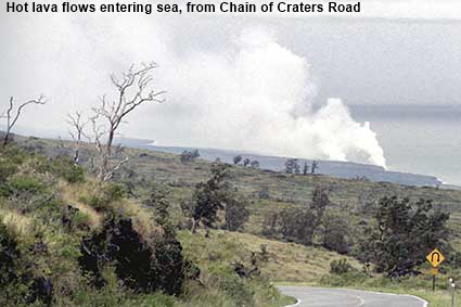
Hot lava flows entering sea, from Chain of Craters Road
When we visited in 1990 part of Chain of Craters Road had been destroyed by by lava flowing into the sea. Needless to say the road was closed some distance from the lava flow for safety reasons. This was part of an eruption from the Pu‘u ‘O‘o-Kupaianaha vent which in 1986 destroyed much of the town of Kalapana. The smoke visble in the distance is the result of hot lava making contact with the sea. Since 1983 lava flows have added 220 hectares (544 acres) to the Big Island.
DLU161014
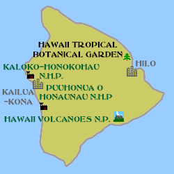
Click on Minimap to navigate
Home > US States > The West > Hawaii > Big Island >
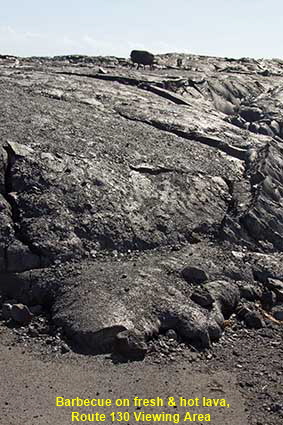
Barbecue on fresh & hot lava, Route 130 Viewing Area
In 1990 the destruction of Kalapana was relatively recent and we saw no sign of rebuilding work. Between our visits a few former residents built new properties on top of the fresh lava. In 2010 Kilauea struck Kalapana again, destroying one of the new properties. When we arrived in early 2011 the National Park Service had set up a viewing area at the point where Route 130 had been cut by the lava flow. This picture shows the river of lava that had come down the volcano, but what it can’t convey is the amount heat that was still coming off it. And what is that black blob on top of the lava flow? That is a blackened barbecue picked up by the lava flow.


To move forwards or backwards through the Big Island Trail click the arrows above, or select your next destination on the Minimap.

© Mike Elsden 1981 - 2025
The contents of this page may not be reproduced in full or in part without permission