Haleakala National Park
The eastern side of Maui is formed by a massive shield volcano called Haleakala which means ‘House of the Sun’ in Hawaiian. A shield volcano is formed by very fluid lava flows that form relatively gentle slopes unlike the conical, steep sided stratovolcanoes that are prone to explosive eruptions. They are called shield volcanoes because the shape resembles a battle shield left face up on the ground. Shield volcanoes may lack the dramatic shape of the stratovolcanoes, but they make up for this through their sheer size. Haleakala occupies 77% of the island of Maui, rising up to a height of 3,055 metres (10,023 feet). It has been erupting for 30,000 years and may last have erupted in the late 1700s although recent radiocarbon analysis suggests that the last eruption may have been 2-300 years earlier. It is still considered capable of further eruptions. Hawaii National Park was founded in 1916 with land on Halealaka on Maui plus Mauna Loa and Kilauea on the Big Island. In 1961 the sections on the two islands became separate National Parks and Haleakala National Park was born. Most of Haleakala National Park is wilderness but there are has two distinct areas accessible by road, the summit of Haleakala and the south eastern coastal area known as the Kipahulu Coast.
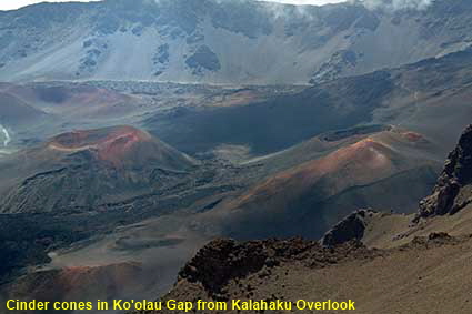
Cinder cones in Ko'olau Gap from Kalahaku Overlook
While shield volcanoes lack the distinctive shape of stratovolcanoes, on Haleakala there are clues to its origins in the wilderness area. These cinder cones mark the sites of old volcanic vents.
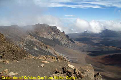
Crater rim of Ko'olau Gap from Visitor Center
From the Visitor Center you can look out over the wilderness area of Haleakala. From here a series of walking trails can take you right down to Kaupo near the coast.
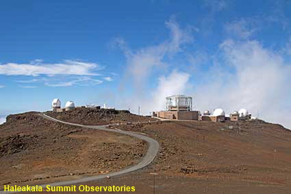
Haleakala Summit Observatories
From the main airport at Kahului it is a 62 kilometre (39 mile) drive to the summit area of Haleakala National Park. The last 34 km (21 miles) of the road zig zags its way up the side of the volcano. The first thing that you notice when you step out of your car is that you have left behind the balmy weather of the Hawaiian coast, up here the air is pretty cold and dry. The cool, dry air and low levels of light pollution have made the top of Haleakala an ideal location for observatories. The University of Hawaii, US Air Force and many others have facilities at this astrophysical complex. The complex is outside of the National Park and is not open to the public.
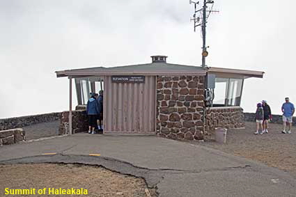
Summit of Haleakala
At 3,055 metres (10,023 feet) above sea level, the highest point of Haleakala, the National Park Service has built a shelter to allow those who have arrived without warm clothing to observe the view out of the cold winds. The National Park is open 24 hours, so it is possible to view the sunrise and sunset or even stargaze from here. When we visited the view was largely obscured by cloud but at times we could see the tops of the volcanoes on the Big Island. Click Tab 2 to see the summits of Mauna Kea & Mauna Loa on the Big Island from Haleakala Summit.
DLU160713
Click on Minimap to navigate
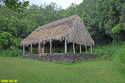
Hale ku'ai
The Kipahulu Coast part of Haleakala National Park is reached via the coastal highway. A section of this road around Kaupo is unsurfaced (unpaved) for over 6 kilometres (4 miles). The road passes through two short sections of the the National Park, one section around Alelele Stream and the other around Pipiwai Stream . There are few facilities in the area around Alelele stream but the other area has a Visitor Center, camp ground and pools for swimming. This reconstruction of a traditional Hawaiian Hale ku’ai (store house) is in the latter part of the park.
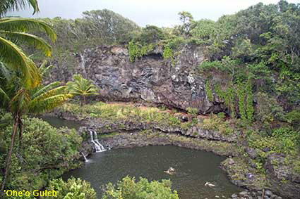
'Ohe'o Gulch
As Pipiwai Stream approaches the Pacific Ocean it passes over waterfalls and through a series of pools known as ‘Ohe’o Gulch (Seven Sacred Pools). The National Park Service does not ban swimming in the pools but it does not recommend it because of the risk of flash floods and potential waterborne bacteria. The coast here is too rocky and turbulent for safe swimming, so many people head for the pools for a swim. In this picture three people enjoy themselves in one of the pools.


To move forwards or backwards through the Maui Trail click the arrows above, or select your next destination on the Minimap.

© Mike Elsden 1981 - 2025
The contents of this page may not be reproduced in full or in part without permission