Crater Lake National Park
One of the best known features of the west coast of the USA is the Cascade Range, a chain of high volcanos running from Washington State down to Northern California. Mount Rainier looms over Seattle, Mount Hood over Portland, and then there is Mount Mazama. Never heard of Mount Mazama? That is because it ceased to tower over southern Oregon around 7,700 years ago when the 3,660 metre (12,000 foot) high mountain collapsed during an eruption. The collapsed of Mount Mazama created a caldera around 1,200 metres (4,000 feet) deep and after it cooled it filled partially with water. The result is the deepest lake in the USA that shows off its blue and green colours against a backdrop of steep cliffs. Crater Lake became a National Park in 1902 and a road circling the rim was opened in 1918.
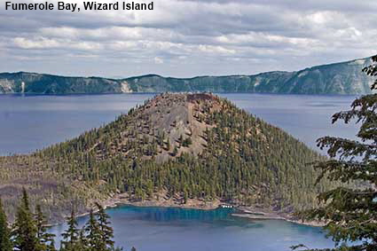
Fumerole Bay, Wizard Island
The colours in Crater Lake can be spectacular but vary considerably according to weather conditions. During our first visit back in 1981 the clouds were down on the higher parts of the rim and the colours were muted. When we visited in 2006 there were flashes of sunshine which brought out brilliant patches of colour, as shown here in Fumerole Bay. We dream that one day we will go back and the Oregon weather will be kind to us!
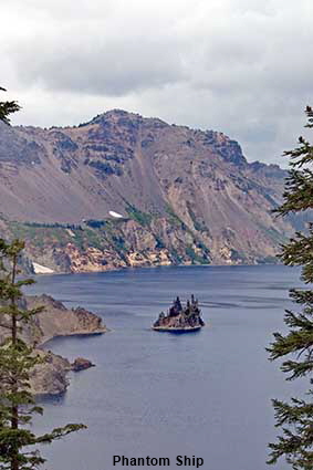
Phantom Ship
Close to the southern shore of Crater Lake under Dutton Cliff a craggy little islet emerges from the water. The combination of crags and trees create a profile that is likened to the hull and masts of a sailing ship. When viewed from the western rim the changing light can one minute pick out the islet and the next make it disappear, hence it is known as the Phantom Ship.
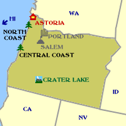
Click on Minimap to navigate
DLU070205
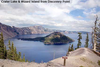
Crater Lake & Wizard Island from Discovery Point
The collapse of Mount Mazama was not the end of volcanic activity in the caldera. On the western side of the lake Wizard Island rises 233 metres (764 feet) above the surface and it is unmistakably a volcanic cinder cone. A second cinder cone, the Merriam Cone, rises near the north shore of the lake but it is completely submerged. There is still some hydrothermal activity on the lake floor suggesting that one day Mount Mazama could erupt again.
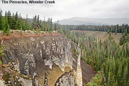
The Pinnacles, Wheeler Creek
The rim is not the only attraction at Crater Lake. A round trip drive of around 20 kilometres (12.5 miles) takes you to Wheeler Creek and its Pinnacles. If Crater Lake itself hasn’t convinced you that Oregon specialises in unusual geological formations then maybe the Pinnacles will. Water has eroded away most of the volcanic rock leaving behind numerous rock columns. These strange outcrops that would not look out of place in an early episode of Star Trek, except that they don’t wobble when pushed.
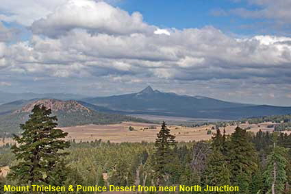
Mount Thielsen & Pumice Desert from near North Junction
The Crater Lake rim is over 2,100 metres (7,000 feet) high at its lowest point so there are also some great views away from the lake. Here the barren area beyond the trees is a part of the National Park known as the Pumice Desert. The explosion of Mount Mazama left a deep layer of pumice and ash here and few plants have been able to take hold. In the distance is the horn shaped peak of Mount Thielsen, a 2,800 metre (9,182 foot) high volcanic peak.
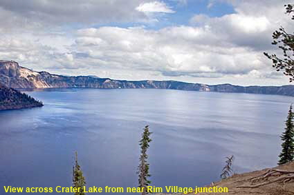
View across Crater Lake from near Rim Village junction
The Rim Drive is only 53 kilometres (33 miles) long, but you need plenty of time to complete it as there are numerous stops along it and from every viewpoint the lake looks different. If you enter the National Park by its southern entrance, this is the first view that you get of the lake. It is roughly circular in shape with with the other side on average around 9 kilometres (5.5 miles) away. The lake has no known inlets or outlets and is 592 metres (1,943 feet) deep.


To move forwards or backwards through the Oregon trail click the arrows above, or select your next destination on the Minimap.

© Mike Elsden 1981 - 2023
The contents of this page may not be reproduced in full or in part without permission